


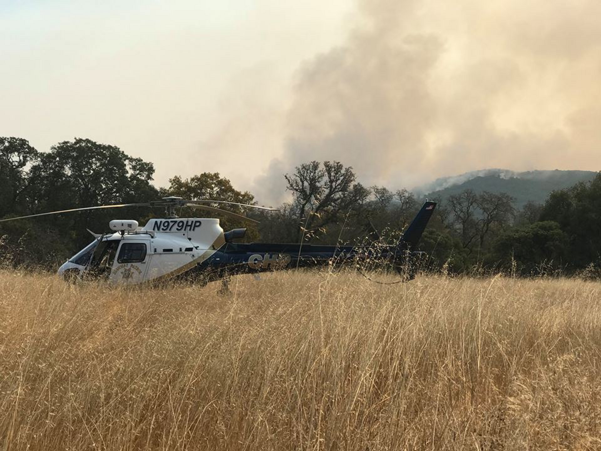
Following the 2018 Heli-Expo airshow in Las Vegas, Nevada, Airbus takes a look at how helicopters helped save lives during the California wildfires of 2017 – an effort that drew on aviation resources for everything from rescues to taking the damage’s toll.
The list of wildfires in CAL FIRE’s “Large Fires” (+300 acres) database requires two pages, detailing sixty individual fires for 2017 that broke out across the state of California and into Nevada. By now, the figures are known, the superlatives (“worst-recorded season”) seem like understatements to the tragedy they describe. Lives were lost, more than 100,000 people were evacuated, all at a cost of more than $10 billion.
Yet the wildfires were contained, thanks to the incredible work of firefighters and their support crews. Supplementing the effort, rotorcraft found their unique qualities in demand as well. While their largest scope involved fighting the fires, perhaps the helicopters’ most visible contribution were rescues.
44 rescues in 48 hours
With aircraft buffeted by hurricane-force winds, crews were literally in the thick of the fires, from the Ventura County Aviation Unit hoisting an injured firefighter to safety, to the 46 rescues by the California Highway Patrol (CHP) in northern California.
The fires that burned Napa and Sonoma – the Atlas, Tubbs, and Nuns fires, among others – came suddenly, quickly, and at night. When distress calls began pouring in from residents trapped by the fire, the CHP responded, rescuing 44 people and seven pets in the first 48 hours, thanks to their access both to fixed-wing aircraft and helicopters. As the emergency worsened, they flew low and used their H125 helicopters’ public address systems, spotlights and sirens to order evacuations, saving the lives of many more.
Recounting the rescue of an injured firefighter, the CHP Golden Gate Division posted on its Facebook page of 22 October: “The CHP officer/pilot placed [helicopter] H-30 into a 75 foot hover and a CHP officer/paramedic hoisted the injured firefighter to Helicopter 30, where he was flown to a waiting air ambulance.”
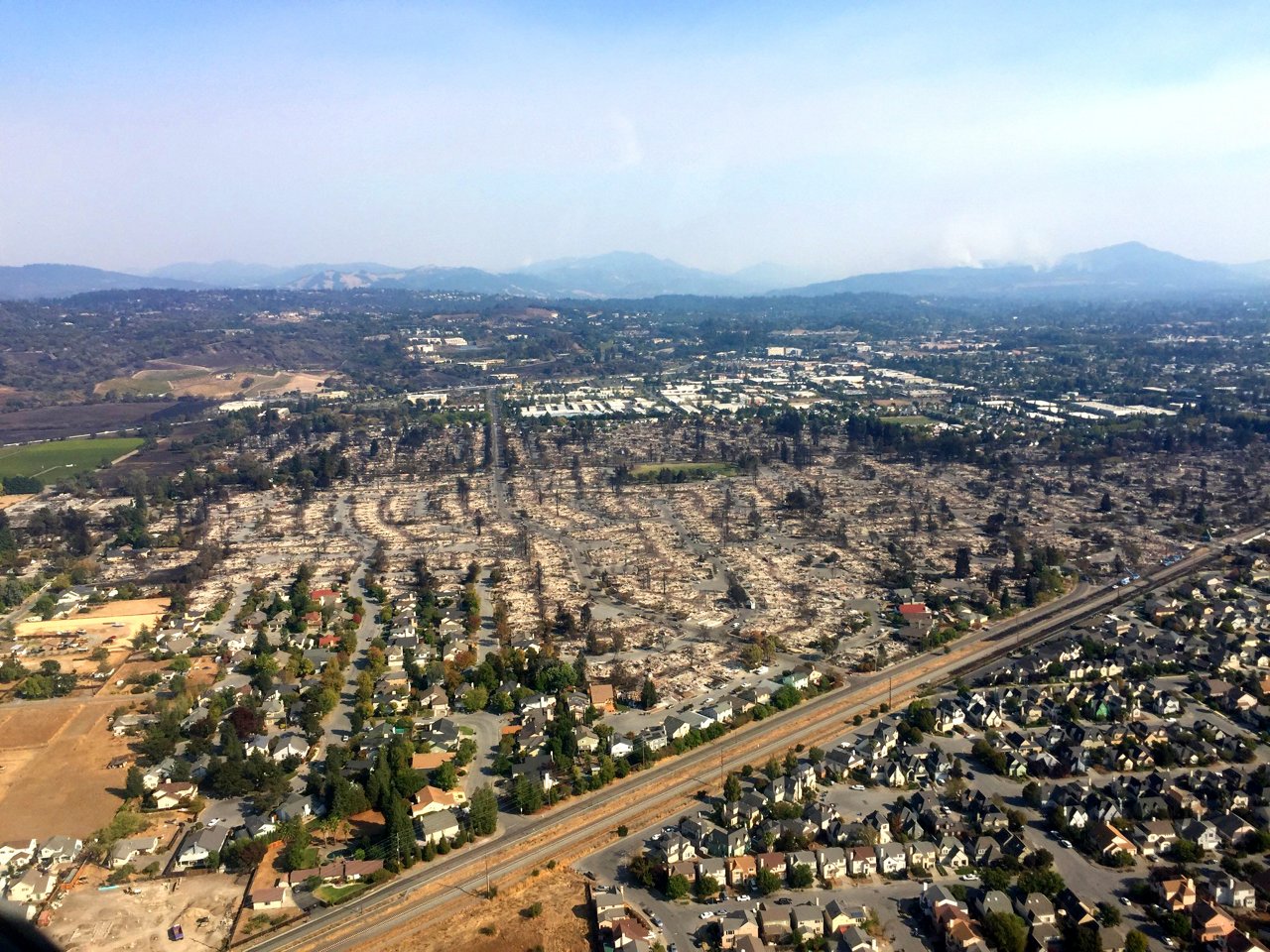
A large section of the city of Santa Rosa in Sonoma County, California, was burned, including the Coffey Park neighborhood.
Photographing the damage
Rescues provided immediate help, but the unheralded work of surveying the damage for the Federal Emergency Management Agency (FEMA) formed the basis of longer term assistance for devastated communities.
Pilots of the California Army National Guard were called upon to take aerial images of northern California, even as the fires were only partially contained. They employed two UH-72A Lakotas with a Wescam MX-15 camera to document destroyed structures, utility towers, and infrastructure. These images would form the foundation of damage assessments by FEMA, utility companies, and local authorities.
“This is a mission you would typically do after the main firefighting effort was over,” says Major John Allen, a California Army National Guard pilot. “[We wouldn’t normally] go look at houses that are burnt down when there are still active fires. But there was so much damage, and it was so inaccessible, that recovery would have been delayed if we hadn't been able to provide those images.”
Air Force Major Megan Stromberg, the Joint Forces (J2) intelligence officer responsible for collecting damage assessments, stated: "In Napa County, the UH-72 imaged a communications tower on Mt. St. Helena. Firefighters were able to identify key locations for a defensible starting point to implement firefighting measures to save the communications tower from the Tubbs fire.”
An increased risk
“The reduced visibility and large number of aircraft definitely increased the risk of the mission,” says Allen. “We tried to stay out of the way while also completing our mission. The Lakota's robust communication suite and overall stability allowed us to make contact with the different authorities controlling the airspace and provided confidence flying in low visibility conditions.”
The National Guard also employed unmanned aerial vehicles to collect images. In future, with most agencies limited to daytime firefighting, UAVs may be called upon to take on a larger role, containing the fires during the night. Until then, a pause before the next attack.
Airbus has secured 21.J Civil Design Organisation Approval from Australia’s Civil Aviation Safety Authority (CASA), marking a significant milestone for its local operations and enhancing its abi...
Embraer and LATAM Airlines Group have signed a Component Pool Program agreement to support the airline's introduction of 24 Embraer E195-E2 aircraft. In addition to the firm order, LATAM retains o...
Bombardier will return to the 2026 NBAA Business Aviation Convention & Exhibition with a showcase that highlights the company's flagship aircraft, award-winning customer support network and di...
Responding to rising customer interest in always-on, high-speed connectivity, Duncan Aviation has placed a prepaid order for 40 Gogo Galileo HDX systems, marking Gogo’s biggest MRO agreement thi...